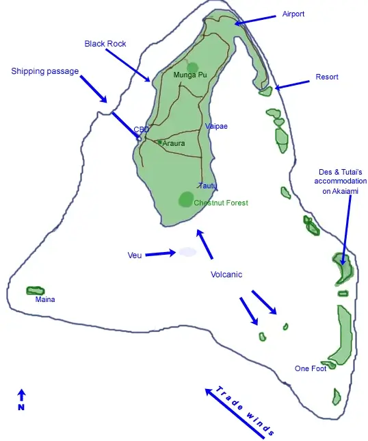
MAP OF AITUTAKI
Where is Aitutaki?
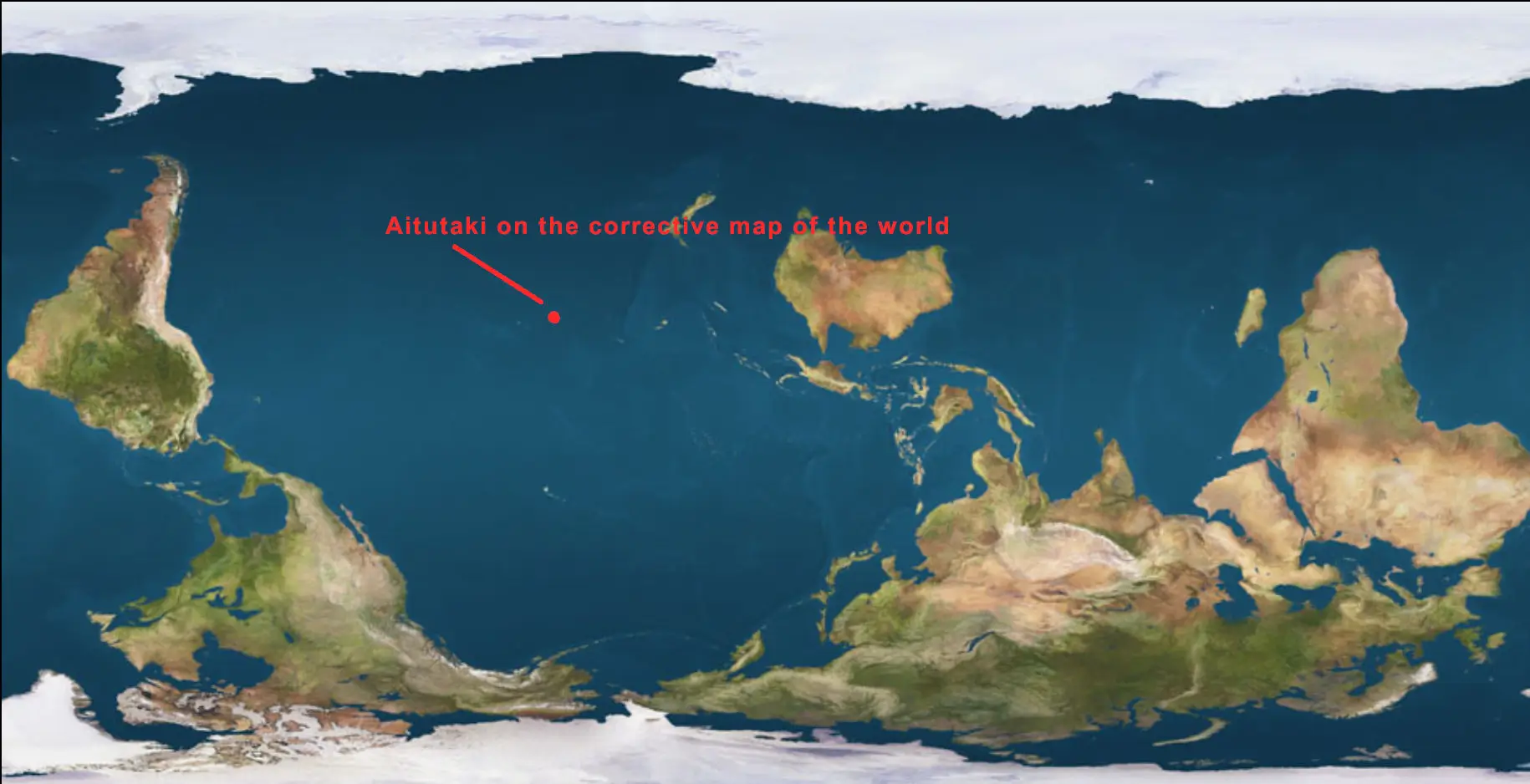
Aitutaki island is located in the Cook Islands which shows on the map of the world below as being in the middle of the South Pacific Ocean, halfway between Australia and Chile. It has the same latitude as Hawaii except south of the equator at -18.838299932967846, and the same longitude as Hawaii at -159.77927525874588. These Aitutake GPS coordinants can be use to navigate to where Aitutaki is. Warning for yachties. This coordinant is exactly at the mountain near the north of Aitutaki named Maunga Pu, 14km north of Aitutaki's southern barrier reef.
Where is Aitutaki's One Foot Island
One Foot Islands is located at the Southeast corner of Aitutaki Island's barrier reef. One Foot island shows on the map of Aitutaki as the island north of Motukitiu, the most southern islet on the eastern barrier reef. When flying from Rarotonga, One Foot island is the second islet you'll see. It looks like a lamb cutlet.
Where is Honeymoon Island?
Honeymoon island is located in the southwest corner of the the island of Aitutaki in the Cook Islands. Map coordinates show it is about 300 metres west of the islet of Maina. This cay has been planted with coconut palms that provides shade on its sandy beach.
Google Map of Aitutaki?
Below, zoom to Aitutaki on Google's interactive upside down map of the world.
Map of Aitutaki Cook Islands |
|
|
|